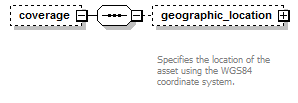
coverage
Element Information
Model
Children: geographic_location
Source
<xs:element name="coverage" minOccurs="0"> <xs:complexType> <xs:sequence> <xs:element name="geographic_location" minOccurs="0"> <xs:annotation> <xs:documentation>Specifies the location of the asset using the WGS84 coordinate system.</xs:documentation> </xs:annotation> <xs:complexType> <xs:sequence> <xs:element name="longitude" type="xs:float"/> <xs:element name="latitude" type="xs:float"/> <xs:element name="altitude"> <xs:annotation> <xs:documentation>Altitude is always given in meters. If the mode is "absolute", then the value is interpreted as meters from mean sea level. If the mode is "relativeToGround" then the value is interpreted as meters above the actual ground elevation at that particular location.</xs:documentation> </xs:annotation> <xs:complexType> <xs:simpleContent> <xs:extension base="xs:float"> <xs:attribute name="mode" type="altitude_mode_enum" default="relativeToGround"/> </xs:extension> </xs:simpleContent> </xs:complexType> </xs:element> </xs:sequence> </xs:complexType> </xs:element> </xs:sequence> </xs:complexType> </xs:element> |